
Metairie, Louisiana.
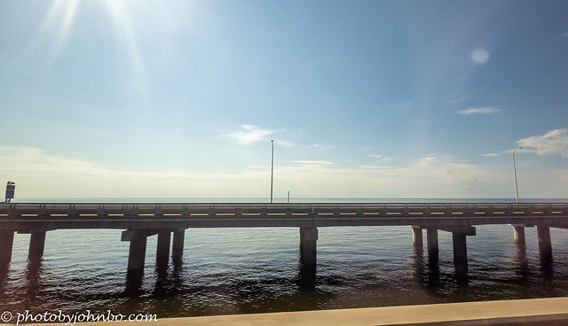
The Lake Pontchartrain Causeway bridges are a pair of parallel bridges that cross Lake Pontchartrain in southeastern Louisiana, United States. The longer of the two bridges is 23.83 miles (38.35 km) long, making it the longest continuous bridge over water in the world. The southern terminus of the causeway is in Metairie, Louisiana, a suburb of New Orleans, and the northern terminus is in Mandeville, Louisiana.
The causeway bridges were built in the 1950s and 1960s to provide a direct connection between New Orleans and the North Shore. Prior to the construction of the causeway, the only way to travel between the two shores was by ferry or by driving around the lake, which added about an hour to the journey.

There are seven crossovers on the Lake Pontchartrain Causeway, spaced approximately 3.5 miles (5.6 km) apart. The crossovers are meant to be for emergency stopping only. Crossovers are important safety features on the two bridges. They allow drivers to pull off the road if they experience a problem, such as a flat tire or a mechanical failure. The crossovers also provide a safe place for emergency vehicles to stop and respond to incidents.
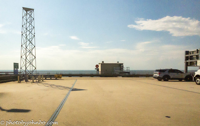
If you ever need to use a crossover on the Lake Pontchartrain Causeway, be sure to pull over completely and turn on your hazard lights. There are also areas along the spans on the right side for emergency stops. There are no places for sightseers to pull off to take photos. All of these images were captured by my cellphone as we transited the northbound bridge.

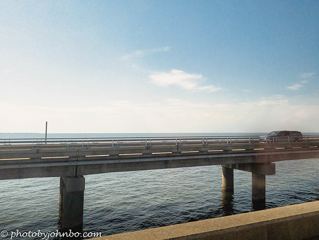
Even at six miles (9.6 km), the north shore of the lake is all but invisible on the horizon. The speed limit is 65 MPH, and at that rate, it took us about 25 minutes to cross the causeway.
The causeway bridges are supported by over 9,000 concrete piles that are driven into the bottom of the lake. The bridges are made up of a series of prefabricated concrete slabs that were barged out to the construction site and assembled using a floating crane.
This view through the windshield shows that the bridges have tall sections that allow larger boats to pass underneath. If you click on the image to view it in Flickr, you can see one of the crossovers between the two bridges.
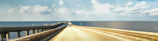
I experimented with some images captured from through the windshield of the Chevy Suburban we were in. I was seated in the rear seat behind the driver when I captured this image between the front seats. I used a new feature in Photoshop to create this panorama. I will fill you in on the details in the upcoming Cellpic Sunday. In the meantime, you can get a view of all these images in 2K HD on my Flickr site here.
John Steiner

Wow! That’s quite something. Thanks for sharing these images.
Our first time crossing was an experience!
Wow, that’s an impressive structure. I’m always amazed by the complexity of building such a thing… imagine going to work in the morning and just being out in the middle of the lake all day. Even just driving over a lake for that length of time must have been a bit of a weird feeling.
Yes, Diana, 26 miles took us about 25 minutes or so at around 60 miles per hour. It was truly an interesting experience. I’d have loved to use one of the pull-offs, but they are for emergencies only.
What an awesome place!
It is quite a feat of construction, for sure.
Crossed this going from TX to AL in the 70’s☺️
Sent from Yahoo Mail for iPhone
We are planning a New Orleans trip in January, we may do it again from the other direction just for fun. 🙂
These are amazing images of the causeway. Anita
Thanks, Anita. It was a challenge to get the photos from the back seat of a vehicle moving at about 60 mph.
Thanks John
That’s an incredibly long span! I can understand why you were tempted to use the pull-off! I would be, too. It’s a wise design feature, for sure.
Indeed. We did see one car and tow truck in one of the pull-offs.
Wow, that’s a long bridge!!
It is, indeed! At mile marker 6, you cannot see the opposite shore. It is still 20 miles away.
Definitely wow! 🙂
I was lucky enough to drive over this long bridge across Lake Pontchartrain. I have mixed memories of it, because while it was exciting to experience, the view is rather limited. The sides are hidden by the railings and there’s no opportunity to stop. It’s certainly easier to monitor this way, but in the age of tourism it’s a bit frustrating.
You are correct in that the bridge doesn’t have particularly awe-inspiring views. I was lucky to get the photos I captured given motion and barriers. My limited view in the vehicle didn’t help.
An amazing feat of engineering!
It is, indeed!
[…] vehicle as we traveled at 65 MPH across the bridge. You can check my recent Travel Tuesday post here to see the images I captured as we crossed the largest overwater bridge in the […]
wow, John, that’s a pair of crazy long bridges! here in Bali there’s a toll road over the water, too, but not even 13km long and I already felt like it’s an endless road when driving alone at night especially, haha… at daytime we can still see the shores so it doesn’t feel so intimidating.
https://en.wikipedia.org/wiki/Bali_Mandara_Toll_Road
There are some long bridges in the swampland of the southern U.S. for sure. If you look at the image featuring mile marker 6, you can see only water in the background. It’s too far to see the opposite shore.
Yes, that image, I imagined the horror of driving at night in an endless road and no lights in sight other than the streetlights (it’s just me being a scaredy cat). But perhaps such scenario is quite common in America where you need to drive past wide stretches of wilderness to get from one city to another? Fascinating…
I just checked your link. It’s a new bridge, only a decade old! Cool!